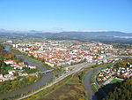
Celje Airfield
Appearance
Celje Airport Letališče Celje (Letališče Levec) | |||||||||||
|---|---|---|---|---|---|---|---|---|---|---|---|
 | |||||||||||
| Summary | |||||||||||
| Airport type | Public | ||||||||||
| Operator | Aeroclub Celje | ||||||||||
| Serves | Celje | ||||||||||
| Location | Levec | ||||||||||
| Elevation AMSL | 801 ft / 244 m | ||||||||||
| Coordinates | 46°14′37″N 15°13′32″E / 46.24361°N 15.22556°E | ||||||||||
| Website | http://www.aeroklub-celje.si/ | ||||||||||
| Runways | |||||||||||
| |||||||||||
Celje Airport (ICAO: LJCL) (Slovene: Letališče Celje or Letališče Levec) is a sport airport, located to the north of Levec near Celje in Slovenia.[1]
References
- ^ "Ministry of Transport of the Republic of Slovenia, list of airports". Archived from the original on 2010-02-28. Retrieved 2010-07-08.


