Aankhibhui
Aankhibhui
आँखिभुईं | |
|---|---|
| Coordinates: 27°13′N 87°17′E / 27.21°N 87.28°E | |
| Country | |
| Zone | Kosi Zone |
| District | Sankhuwasabha District |
| Population (1991) | |
• Total | 7,019 |
| Time zone | UTC+5:45 (Nepal Time) |
| Postal code | 56910 |
| Area code | 029 |
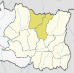
Aankhibhui is a village development committee in Sankhuwasabha District in the Kosi Zone of north-eastern Nepal. At the time of the 1991 Nepal census it had a population of 7019 people living in 1296 individual households. It was VDC with highest population in the district.[1]
Education
[edit]This VDC has three secondary schools which are named as Mahendra Jyoti Madhyamik Bidhyalaya after the name of former King Mahendra, Amaruwa Madhyamik Bidhyalaya after the name of one of the wards in the village and latest established is Bhagawati Madhyamik Bidhyalaya. ″Amaruwa Ma. Vi.″
″Mahendra Jyoti Ma. Vi.″ It was established by past gaun panchayat president Buddhi Bahadur Basnet and other three people from the same panchayat have contributed to his work. Later his work was upgraded by many villagers. Chewan chandra Basnet, Min bahadur Karki, Chandra Bahadur Bharati and Sher Bahadur Karki have built the school building.
″Bhagawati Ma. Vi.″
References
[edit]- ^ "Nepal Census 2001". Nepal's Village Development Committees. Digital Himalaya. Archived from the original on 12 October 2008. Retrieved 19 November 2008.
External links
[edit]


