
Oborná
Oborná | |
|---|---|
 Church of the Holy Trinity | |
 Flag  Coat of arms | |
 Oborná Location in the Czech Republic | |
| Coordinates: 50°0′11″N 17°29′49″E / 50.00306°N 17.49694°E | |
| Country | |
| Region | Moravian-Silesian |
| District | Bruntál |
| First mentioned | 1405 |
| Area | |
| • Total | 5.33 km2 (2.06 sq mi) |
| Elevation | 495 m (1,624 ft) |
| Population (2023-01-01)[1] | |
| • Total | 446 |
| • Density | 84/km2 (220/sq mi) |
| Time zone | UTC+1 (CET) |
| • Summer (DST) | UTC+2 (CEST) |
| Postal code | 792 01 |
| Website | www |
Oborná (until 1947 Špilendorf; German: Spillendorf) is a municipality and village in Bruntál District in the Moravian-Silesian Region of the Czech Republic. It has about 400 inhabitants.
History
The first written mention of Oborná is from 1405.[2]
According to the Austrian census of 1910, the village had 511 inhabitants, all of them were German-speaking. The most-populous religious group were Roman Catholics with 505 (98.8%).[3]
Gallery
-
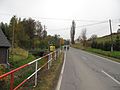 Main road
 -
 Cemetery
 -
 Side street


References
- ^ "Population of Municipalities – 1 January 2023". Czech Statistical Office. 2023-05-23.
- ^ "Historie obce" (in Czech). Obec Oborná. Retrieved 2022-04-27.
- ^ Ludwig Patryn (ed): Die Ergebnisse der Volkszählung vom 31. Dezember 1910 in Schlesien, Troppau 1912.
External links
Wikimedia Commons has media related to Oborná.
This Moravian-Silesian Region location article is a stub. You can help Wikipedia by expanding it. |