Morasiya
Morasiya
Morasia | |
|---|---|
Village | |
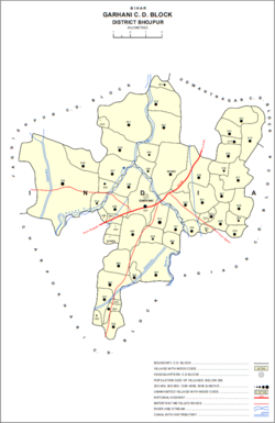
 Map of Morasiya (#538) in Garhani block | |
| Coordinates: 25°25′50″N 84°30′40″E / 25.43052°N 84.51098°E[1] | |
| Country | India |
| State | Bihar |
| District | Bhojpur |
| Area | |
| • Total | 0.206 km2 (0.080 sq mi) |
| Elevation | 72 m (236 ft) |
| Population (2011) | |
| • Total | 1,796[2] |
| Languages | |
| • Official | Bhojpuri, Hindi |
| Time zone | UTC+5:30 (IST) |
| PIN | 802203[2] |
Morasiya, also spelled Morasia, is a village and in Garhani block of Bhojpur district, in Bihar, India. As of 2011, its population was 1,796, in 255 households.[2]
Morasiya is an impoverished village, with most villagers being employed in agriculture and a few being migrant workers. The population is mostly Yadavs and Rajputs. The village has three neighbourhoods, Matthiya to the east and Sridhar ka Tola to the west and Ayar to the north. The houses in Matthiya are made of bricks and cement, while those in Sridhar ka Tola are made of mud and clay. Electricity is available for 15–17 hours per day throughout the year. Drinking water is provided via hand pumps, which are installed in every house. Every house additionally has proper sanitation facilities, although a few villagers prefer open defecation instead. Morasiya has one primary school.[3]
Healthcare in Morasiya is poor. The village lacks an Accredited Social Health Activist, and the nearest Primary Health Centre is 8 km (5.0 mi) away. A majority of children in Morasiya suffer from skin diseases, especially in the summer, including pyoderma, scabies, and atopic dermatitis.[3]
References
- ^ a b "Geonames.org. Morasiya". Retrieved 20 August 2020.
- ^ a b c d "Census of India 2011: Bihar District Census Handbook - Bhojpur, Part A (Village and Town Directory)". Census 2011 India. pp. 604–627. Retrieved 20 August 2020.
- ^ a b Hooda, Mohit; Gupta, Abhijeet; Ramesh, Meera; U, Rahul; Nair, Jayashree; Mohan, Renjith (2020). "Computing for the Mitigation of Health Vulnerabilities for the Village Morasiya in Bihar, India". In Kumar, Amit; Paprzycki, Marcin; Gunjan, Vinit Kumar (eds.). ICDSMLA 2019: Proceedings of the 1st International Conference on Data Science, Machine Learning and Applications. Singapore: Springer Nature. pp. 1662–1672. ISBN 978-981-15-1420-3.


