Great Doddington
This article needs additional citations for verification. (November 2009) |
| Great Doddington | |
|---|---|
 Parish church | |
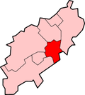
Location within Northamptonshire | |
| Population | 1,123 (2011) |
| OS grid reference | SP8764 |
| Unitary authority | |
| Ceremonial county | |
| Region | |
| Country | England |
| Sovereign state | United Kingdom |
| Post town | Wellingborough |
| Postcode district | NN29 |
| Dialling code | 01933 |
| Police | Northamptonshire |
| Fire | Northamptonshire |
| Ambulance | East Midlands |
| UK Parliament | |
Great Doddington is a village and civil parish in Northamptonshire, England, close to Wellingborough and just off the A45. At the time of the 2001 census, the parish's population was 1,061[1] increasing to 1,123 at the 2011 census.[2]
The name Dodda's Tun probably refers to an Anglo-Saxon leader 'Dodda' establishing a stronghold in the strategic position overlooking the Nene Valley. Domesday Book records the principal landowner as Judith, widow of Waltheof II, Earl of Northumbria.
The Church of England St Nicholas Church dates back to Norman days and has a square tower and four 15th century misericords. The village contains a village shop, and two churches, St Nicholas' and a United Reformed Chapel.
The civil parish contains two wards.[3]
References
- ^ Office for National Statistics: Great Doddington CP: Parish headcounts. Retrieved 9 November 2009
- ^ "Civil Parish population 2011". Neighbourhood Statistics. Office for National Statistics. Retrieved 4 July 2016.
- ^ Statutory Instrument 1998 No. 2510
External links
- The village's official website
- The Parish Church's official website
- Great Doddington Photos Great Doddington Flickr photo pool
- Great Doddington Primary School


