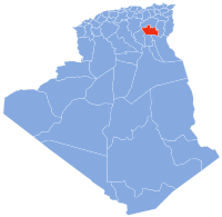
Lioua
Appearance
Lioua | |
|---|---|
Commune and town | |
 | |
| Coordinates: 34°38′15″N 5°23′45″E / 34.63750°N 5.39583°E | |
| Country | |
| Province | Biskra Province |
| Area | |
| • Total | 24,320 km2 (9,390 sq mi) |
| Population (2008) | |
| • Total | 21,416 |
| • Density | 8,806/km2 (22,810/sq mi) |
| Time zone | UTC+1 (CET) |
| Postal code | 07033 |
| Area code | (+213) 033 |
Lioua (Arabic: ليوة) is a town and commune in Ourlal District, of Biskra Province, Algeria. According to the 1998 census it had a population of 15,960,[1] but this had grown to 21,416 in 2008.[2]
The town is on the edge of the Sahara, and the climate is semi-arid.[citation needed] Lioua sits aside the Oued Djedi river that feeds into the Chott Melghir and is 10 km south of Tolga, and like most of that area is known for the production of date palms.[citation needed]
References
[edit]

