Schkeuditz
Schkeuditz | |
|---|---|
 Town center | |
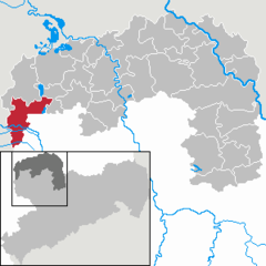
Location of Schkeuditz within Nordsachsen district  | |
| Coordinates: 51°24′N 12°13′E / 51.400°N 12.217°E | |
| Country | Germany |
| State | Saxony |
| District | Nordsachsen |
| Subdivisions | 10 |
| Government | |
| • Mayor (2017–24) | Rayk Bergner[1] (CDU) |
| Area | |
• Total | 79.36 km2 (30.64 sq mi) |
| Highest elevation | 148 m (486 ft) |
| Lowest elevation | 91 m (299 ft) |
| Population (2022-12-31)[2] | |
• Total | 19,189 |
| • Density | 240/km2 (630/sq mi) |
| Time zone | UTC+01:00 (CET) |
| • Summer (DST) | UTC+02:00 (CEST) |
| Postal codes | 04435 |
| Dialling codes | 034204 |
| Vehicle registration | TDO, DZ, EB, OZ, TG, TO |
| Website | www.schkeuditz.de |
Schkeuditz (German pronunciation: [ˈʃkɔʏdɪts] ) is a Große Kreisstadt in the district of Nordsachsen, in Saxony, Germany. It is situated on the White Elster river, 12 km northwest of Leipzig. Leipzig/Halle Airport is located in Schkeuditz. The letter processing center for the greater Leipzig region is also located in Schkeuditz. "Schkeuditzer Kreuz", the first cloverleaf exchange in Germany was opened in 1936[3] and is today the intersection between the autobahns A9 and A14.
History
Schkeuditz was first documented in the year 981 as a church in Merseburg bishopric with the name "scudici".
Population over time
The population development over time is given in the following table. Like many towns in east Germany, the population is lower today than just after reunification.
| Year | Pop. |
|---|---|
| 1885 | 4,592 |
| 1910 | 7,462 |
| 1925 | 7,936 |
| 1933 | 13,548 |
| 1939 | 14,846 |
| 1950 | 18,913 |
| 1971 | 16,392 |
| 1981 | 14,208 |
| 1988 | 15,173 |
| 1990 | *19,473 |
| 1998 | 17,285 |
| 2001 | 19,027 |
| 2003 | 18,702 |
| 2005 | 18,594 |
| 2007 | 18,150 |
| 2011 | 17,413 |
| 2012 | 16,877 |
| 2013 | 16,961 |
| 2017 | 17,587 |
| ^* Using the current town boundaries. The town boundaries have expanded over time as shown in § Annexations. Source: [4] | |
Annexations
| Former district | Date | Comment |
|---|---|---|
| Bienitz | 1 January 2000 | only Dölzig and Kleinliebenau |
| Dölzig | 1 January 1994 | Merged with Burghausen and Rückmarsdorf to Bienitz |
| Freiroda | 1 March 1994 | Merged with Radefeld |
| Gerbisdorf | 1 December 1972 | Merged with Freiroda |
| Glesien | 1 January 1999 | |
| Hayna | 1 July 1973 | Merged with Radefeld |
| Kleinliebenau | 1 January 1957 | Merged with Dölzig |
| Kursdorf | 1 January 1994 | |
| Lössen | 1 July 1950 | Merged with Wolteritz |
| Radefeld | 1 January 1999 | Partial disbursal to Leipzig (7 inhabitants) |
| Wehlitz | 1 July 1950 | |
| Wolteritz | 1 March 1994 | Annexed Radefeld |
People
- Gerhard W. Menzel (1922-1980), writer
- Frank Siebeck (born 1949), hurdler
- Mark Siebeck (born 1975), volleyball player
- Peter Sack (born 1979), shot putter
References
- ^ Bürgermeisterwahlen 2017, Freistaat Sachsen, accessed 12 July 2021.
- ^ "Einwohnerzahlen nach Gemeinden als Excel-Arbeitsmappe" (XLS) (in German). Statistisches Landesamt des Freistaates Sachsen. 2024.
- ^ "Europas erste Autobahnkreuz: Schkeuditzer Kreuz". bild.de (in German). Retrieved 2020-01-28.
- ^ www.schkeuditz.de (lt. Einwohnermeldeamt Schkeuditz vom 24.04.2017). September 2017


