Bay of Grama
| Grama Bay | |
|---|---|
| Gjiri i Gramës | |
 Grama Bay | |
| Location | Southern Europe |
| Coordinates | 40°12′56″N 19°28′24″E / 40.21556°N 19.47333°E |
| Ocean/sea sources | Ionian Sea, Mediterranean Sea |
| Basin countries | Albania |
| Max. width | ca. 100 m (330 ft) |
| Average depth | ca. 200 m (660 ft) |
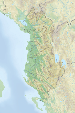
The Bay of Grama (Albanian pronunciation: [ˈɟiːɾi i ˈgraːməs] — Template:Lang-sq) is a bay in the Ionian Sea situated along the Albanian Ionian Sea Coast on the Mediterranean Sea in Southern Europe. It is one of many bays of the western Ceraunian Mountains along the Albanian Riviera south of the Karaburun Peninsula.[1] The bay is primarily known as a touristic place, and for the engraved inscriptions in the surrounding coastal cliffs as its name relieves.
Name
The name of the bay is closely associated with the engraved inscriptions in the surrounding coastal cliffs; Grama for the Greek word for 'letter'.[2][3] It is also referred to as Gram(m)ata, the plural form of 'Gram(m)a' from the inscriptions of thanksgiving left by Greek, Roman and medieval sailors in honour of the Dioscuri, Castor and Pollux, and other patrons.[4][5]
Human history
In antiquity the bay of Grama was a cove along the Chaonian coast west of the Ceraunian Mountains.[6] The bay is home to precious archaeological, historical and cultural values, as it served as an important harbour and shelter for those sailing along the coast during classical antiquity.[7] On the vertical cliffs and rocks, there are numerous carved inscriptions in Ancient Greek, Latin and Medieval Greek.[8] This kind of inscriptions were known in antiquity as euploia (Template:Lang-el) inscriptions.[9]
During the Second World War, it was used as a base for the Special Operations Executive.[10]
Geomorphology
Representing a rocky bay, the shore is dominated by coastal cliffs, sloping vertically into the sea and rocky, pebbled beaches. It stretches within the Karaburun-Sazan Marine Park and was designated as a natural monument because of its outstanding landscape dotted with solutional and sea caves.[11][12]
Biodiversity
The precious landscapes of the bay are of global importance, because they contribute to the country's ecological balance and provide habitat for numerous globally threatened and endangered species. The sea caves are an exceptional ecosystem and give important refuge to the mediterranean monk seal, the rarest seal species in the world.[13][14]
See also
- Albanian Ionian Sea Coast
- List of bays of Albania
- Biodiversity of Albania
- Geography of Albania
- Protected areas of Albania
References
- ^ Agjencia Kombëtare e Zonave të Mbrojtura (AKZM). "Gjiri dhe shpella e Gramës". akzm.gov.al (in Albanian). Tirana. Archived from the original on 2018-06-18. Retrieved 2018-07-06.
- ^ "Discover Albania: Green Coast Attractions" (PDF). p. 16. Retrieved 30 September 2019.
- ^ Peter Lucas (16 February 2015). The OSS in World War II Albania: Covert Operations and Collaboration with Communist Partisans. McFarland, 2017. p. 50. ISBN 978-1-4766-0943-0.
- ^ Nicholas Geoffrey Lemprière Hammond (1994). Collected studies. Hakkert. p. 401.
- ^ Agnes Jensen Mangerich (2006). Albanian Escape: The True Story of U.S. Army Nurses Behind Enemy Lines. University Press of Kentucky. p. 204.
- ^ De Maria, Sandro; Mancini, Lorenzo (2018). "Territori e paesaggi sacri nella Caonia ellenistica e romana". In Adolfo J. Domínguez (ed.). Politics, Territory and Identity in Ancient Epirus. Edizioni ETS. p. 207. ISBN 978-88-467-4830-0.
- ^ "THE FIRST MPA IN ALBANIA, SAZANI ISLAND – KARABURUNI PENINSULA, AS A REGIONAL PRIORITY CONSERVATION AREA FOR MARINE BIODIVERSITY" (PDF). zrsvn.si. Archived from the original (PDF) on 2014-08-19. Retrieved 2018-07-07.
- ^ Hajdari, Arben; Reboton, Johany; Shpuza, Saïmir; Cabanes, Pierre (2007). "Les inscriptions de Grammata (Albanie)". Revue des Études Grecques. 120 (2): 353–394. doi:10.3406/reg.2007.7870.
- ^ Morais, Rui; Leão, Delfim; Pérez, Diana Rodríguez; Ferreira, Daniela (11 March 2019). Greek Art in Motion: Studies in honour of Sir John Boardman on the occasion of his 90th Birthday. Archaeopress Publishing Ltd. p. 346. ISBN 978-1-78969-024-8.
- ^ Roderick Bailey: The Wildest Province SOE In the Land of the Eagle, Vintage 2009 p206
- ^ "Management Plan for National Marine Park Karaburun-Sazan" (PDF). mcpa.iwlearn.org. p. 10.
- ^ Instituti i Monumenteve të Kulturës (IMK). "LISTA E MONUMENTEVE TË KULTURËS - QARKU VLORË 2017" (PDF). imk.gov.al (in Albanian). Archived from the original (PDF) on 2018-07-12. Retrieved 2018-07-06.
- ^ Ministria e Mjedisit, Pyjeve dhe Administrimit të Ujrave. "Protected area gap assessment, marine biodiversity and legislation on marine protected areas" (PDF). undp.org. Tirana. p. 61. Archived from the original (PDF) on 2017-08-02. Retrieved 2018-07-07.
- ^ World Wide Fund for Nature. "Mediterranean Monk Seal One Of The Rarest Mammals In The World". wwf.panda.org/.
Sources
- Hajdari, Arben; Reboton, Joany; Shpuza, Saïmir; Cabanes, Pierre (2007). "Les Insciprtions de Grammata (Albanie)". Revue des Études Grecques. 120 (2): 353–394. doi:10.3406/reg.2007.7870. ISSN 0035-2039. Retrieved 1 October 2019.


