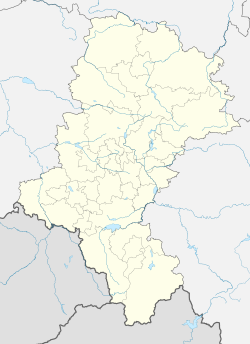
Chałupki, Racibórz County
Appearance
This article needs additional citations for verification. (January 2022) |
Chałupki | |
|---|---|
Village | |
 Palace | |
 | |
| Coordinates: 49°55′28″N 18°19′6″E / 49.92444°N 18.31833°E | |
| Country | |
| Voivodeship | |
| County | Racibórz |
| Gmina | Krzyżanowice |
| First mentioned | 1373 |
| Government | |
| • Mayor | Ryszard Chrobok |
| Population (2015) | |
| • Total | 725[1] |
| Time zone | UTC+1 (CET) |
| • Summer (DST) | UTC+2 (CEST) |
| Postal code | 47-460 |
| Car plates | SRC |
Chałupki [xaˈwupki] is a village in Racibórz County, Silesian Voivodeship, Poland. Its total area is .777 km2.[1]
It lies on the border with Czech Republic, on the Chałupki - Bohumín railway line.
References
- ^ a b "Chałupki - Overview, Area, Total population". City Facts. Retrieved 22 January 2022.
External links
Wikimedia Commons has media related to Chałupki, powiat raciborski.
- Jewish Community in Chałupki on Virtual Shtetl


