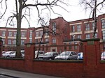
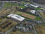
St Andrew's Secondary School, Glasgow
Appearance
| St Andrew's Secondary School | |
|---|---|
| Address | |
 | |
47 Torphin Crescent , G32 6QE Scotland | |
| Coordinates | 55°51′39″N 4°10′08″W / 55.8608°N 4.1689°W |
| Information | |
| Type | Comprehensive secondary school |
| Motto | Putting Young People First or Fidus et Audax (Faithful and Courageous) |
| Religious affiliation(s) | Roman Catholic |
| Local authority | Glasgow City Council |
| Head teacher | Matthew Love[1][2] |
| Years offered | S1-S6 |
| Gender | Mixed |
| Age range | 11–18 |
| Enrolment | 1766 (September 2018) |
| Colour(s) | Blue and Yellow |
| Website | www |
St Andrew's Secondary School is an 11–18 mixed, Roman Catholic comprehensive secondary school in Glasgow, Scotland.[3] Its catchment area includes much of the East End of the city, including such districts as Baillieston, Craigend, Cranhill, Easterhouse, Greenfield, Shettleston, Tollcross and Wellhouse.[4]
Alumni
- David Marshall (born 1985), professional footballer, Hibernian F.C., Scotland national team
- Stephen Hendrie (born 1995), professional footballer, Hamilton Academical F.C.
References
- ^ "Teacher shortage means one head for Holyrood Secondary and St Andrew's RC Secondary". Evening Times. 1 March 2017. Retrieved 29 May 2018.
- ^ "Top marks for St Andrew's". Scottish Catholic Observer. 8 February 2018. Retrieved 29 May 2018.
- ^ Hilley, Sarah (16 May 2022). "East End Glasgow high school to get six new classrooms to cope with demand". GlasgowLive. Retrieved 16 May 2022.
- ^ "School is awarded 'outstanding' inspection report". The Herald. 22 January 2013. Retrieved 29 May 2018.
External links


