Holeylan County
Appearance
Holeylan County
Persian: شهرستان هلیلان | |
|---|---|
County | |
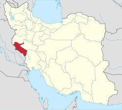
 Location of Holeylan County in Ilam province (top right, green) | |
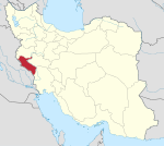
 Location of Ilam province in Iran | |
| Coordinates: 33°47′45″N 47°11′55″E / 33.79583°N 47.19861°E[1] | |
| Country | |
| Province | Ilam |
| Capital | Towhid |
| Districts | Central, Jazman |
| Population (2016)[2] | |
| • Total | 15,276 |
| Time zone | UTC+3:30 (IRST) |
Holeylan County (Persian: شهرستان هلیلان) is in Ilam province, Iran. Its capital is the city of Towhid.[3]
At the 2006 census, the region's population (as Holeylan District of Chardavol County) was 15,191 in 3,066 households.[4] The following census in 2011 counted 14,793 people in 3,696 households.[5] At the 2016 census, the district's population was 15,276 in 4,240 households.[2] It was separated from Chardavol County in 2020 to become Holeylan County.[6][3][7]
Administrative divisions
The population history of Holeylan County's administrative divisions (as a district of Chardavol County) over three consecutive censuses is shown in the following table.
| Administrative Divisions | 2006[4] | 2011[5] | 2016[2] |
|---|---|---|---|
| Central District2 | |||
| Dajivand Rural District2 | |||
| Guran Rural District3 | 12,069 | 10,791 | 10,634 |
| Towhid (city) | 604 | 1,475 | 2,128 |
| Jazman District2 | |||
| Darbid Rural District2 | |||
| Zardalan Rural District | 2,518 | 2,527 | 2,514 |
| Total | 15,191 | 14,793 | 15,276 |
| 1As a part of Chardavol County at the 2006, 2011, and 2016 censuses 2Established after the 2016 census[3] 3Formerly Holeylan Rural District[3] | |||
Wikimedia Commons has media related to Holeylan County.
References
- ^ OpenStreetMap contributors (6 June 2023). "Holeylan County" (Map). OpenStreetMap. Retrieved 6 June 2023.
- ^ a b c "Census of the Islamic Republic of Iran, 1395 (2016)". AMAR (in Persian). The Statistical Center of Iran. p. 16. Archived from the original (Excel) on 1 November 2020. Retrieved 19 December 2022.
- ^ a b c d Janhangiri, Ishaq (26 January 2018). "Approval letter regarding the country divisions of Ilam province". Islamic Parliament Research Center of the Islamic Republic of Iran (in Persian). Ministry of Interior, Council of Ministers. Archived from the original on 16 January 2020. Retrieved 3 June 2023.
- ^ a b "Census of the Islamic Republic of Iran, 1385 (2006)". AMAR (in Persian). The Statistical Center of Iran. p. 16. Archived from the original (Excel) on 20 September 2011. Retrieved 25 September 2022.
- ^ a b "Census of the Islamic Republic of Iran, 1390 (2011)" (Excel). Iran Data Portal (in Persian). The Statistical Center of Iran. p. 16. Retrieved 19 December 2022.
- ^ "Governor of Ilam: Holeylan District was upgraded to a county". Islamic Republic News Agency (in Persian). 8 January 2018. Archived from the original on 30 December 2019. Retrieved 2 June 2023.
- ^ "Approval letter regarding the country divisions of Ilam province". RRK (in Persian). 8 January 2020. Archived from the original on 12 January 2020. Retrieved 6 June 2023.

