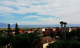
Kasba Tadla
Appearance
Kasbat Tadla
قصبة تادلة ⵇⵚⴱⵜ ⵜⴰⴷⵍⴰ Qaşbat Tādlah | |
|---|---|
Town | |
Streetview | |
 | |
| Country | |
| Region | Béni Mellal-Khénifra |
| Province | Béni Mellal |
| Population (2004) | |
• Total | 40,898 |
| Time zone | UTC+1 (WET) |
| • Summer (DST) | UTC+2 (WEST) |
| Website | https://communekasbatadla.ma/ |
Kasba Tadla (Template:Lang-ar; Berber: ⴰⵢⵜ ⵎⵍⵍⴰⵍ) is a town in Béni-Mellal Province, Béni Mellal-Khénifra, Morocco. According to the 2004 census it has a population of 200 ,898.[1] The highest temperature ever registered in Kasba Tadla was 47.0 °C (116.6 °F), on July 23, 2021.[2]
History
Tadla is an Amazigh name means bouquet of wheat. The city was taken by the Ifrenids in the early eleventh century. The city fell to the Almoravids thereafter to 1068.
Monuments
This section is empty. You can help by adding to it. (December 2013) |
References
- ^ "World Gazetteer". Archived from the original on 2012-12-05.
- ^ "60190: Kasba-Tadla (Morocco)". ogimet.com. OGIMET. 23 July 2021. Retrieved 23 July 2021.
External links
 Media related to Kasba Tadla at Wikimedia Commons
32°36′N 6°16′W / 32.600°N 6.267°W

