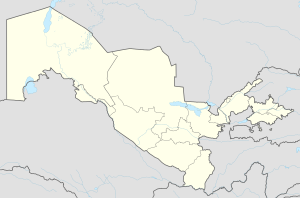
Chorkesar
Appearance
Chorkesar | |
|---|---|
urban-type settlement | |
| Coordinates: 41°01′50″N 70°54′33″E / 41.03056°N 70.90917°E | |
| Country | |
| Region | Namangan Region |
| District | Pop District |
| Urban-type settlement status | 1957 |
| Population (1989) | |
• Total | 1,382 |
| Time zone | UTC+5 (UZT) |
Chorkesar (Template:Lang-uz, Template:Lang-ru) is an urban-type settlement in Namangan Region, Uzbekistan. It is part of Pop District.[1] The town population in 1989 was 1382 people.[2]
In 2021 preparations for the environmental remediation a nearby former uranium mine, and also at Yangiabad, started with the assistance of a €2 million grant from the European Bank for Reconstruction and Development.[3]
References
- ^ "Classification system of territorial units of the Republic of Uzbekistan" (in Uzbek and Russian). The State Committee of the Republic of Uzbekistan on statistics. July 2020.
- ^ Population census-1989 Archived 2012-01-18 at the Wayback Machine
- ^ "Clean-up set to start at Uzbek legacy uranium sites". World Nuclear News. 25 October 2021. Retrieved 26 October 2021.


