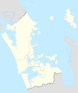
1835 Auckland earthquake
| Local date | 1835 |
|---|---|
| Duration | 10 to 30 seconds |
| Magnitude | 6.5 Mw[1] |
| Depth | 25 km (16 mi)[1] |
| Epicenter | 37°S 175°E / 37°S 175°E[2] |
| Type | Normal |
| Areas affected | Auckland, Waikato |
| Total damage | Possibly Severe |
| Max. intensity | MMI VIII (Severe) |
| Tsunami | No |
| Aftershocks | Many (Possibly between magnitudes 2 and 5)[3] |
| Casualties | Unknown |
The 1835 Auckland earthquake was a magnitude 6.5 earthquake that occurred sometime during 1835 in the Auckland region of New Zealand.[1] The earthquake was caused by movement along the Wairoa North Fault, which runs through the area.[4][5] At the time, the settlement of Auckland was still quite small, and there are limited records of the specific damage caused by the earthquake. However, historical accounts suggest that the earthquake caused significant shaking and rumbling in the area, and it is possible that some buildings or structures may have been damaged or collapsed. Despite this, there are no records of major damage or casualties resulting from the earthquake. The 1835 Auckland earthquake remains an important event in the region's history, particularly as it highlights the seismic activity that can occur in the area due to the presence of faults such as the Wairoa North Fault.[6]
Earthquake
The earthquake shock was felt as far away as Kaitaia and New Plymouth. However, due to the lack of research and studies of this historical earthquake, the full impacts outside of the Auckland region are unknown.[6]
Geology
The earthquake occurred on the Wairoa North Fault, a normal fault[7] that runs on the western side of the Hunua Ranges.[8] The epicenter of the earthquake was located on the Waikopua segment of the Wairoa North Fault. The northern part of the Wairoa North Fault is considered to be its own distinct fault line, with a high level of certainty.[7][9] The Wairoa North Fault is additionally part of the Hauraki Rift, a rift that extends from the Taupo Rift all the way up towards the Hauraki Gulf.[10]
Seismic intensity
It was rated as VI–VII on the Modified Mercalli intensity scale in the central regions of Auckland. However, in the area around the earthquake's epicenter, it was described as "severe," which would classify its intensity at VIII.[6]
See also
- List of earthquakes in New Zealand
- Kerepehi Fault
- Hauraki Rift
- Wairoa North Fault
- Auckland Volcanic Field
References
- ^ a b c "GeoNet Quake – Magnitude 6.5, Thu Jan 1 1835 11:39 AM". GNS Science. Retrieved 14 April 2023.
- ^ "GeoNet Technical – Magnitude 6.5, Thu Jan 1 1835 11:39 AM". GNS Science. Retrieved 14 April 2023.
- ^ Eiby, G.A. (1968). "A descriptive catalogue of New Zealand earthquakes: Part I—Shocks Felt before the end of 1845". New Zealand Journal of Geology and Geophysics. 11 (1). doi:10.1080/00288306.1968.10423671.
- ^ Daly, Michael (26 December 2020). "Auckland, Hamilton, Tauranga vulnerable to earthquakes in Hunua Ranges, Hauraki Plains". Stuff. Retrieved 14 April 2023.
- ^ Fellows, D.L. (September 1996). "Preliminary Paleoseismic Assessment of the Wairoa North fault". ARC Environment. ISSN 1172-6415. Retrieved 14 April 2023 – via Auckland Engineering Lifelines Group.
- ^ a b c Hull, A.G.; Mansergh, G.D.; Townsend, T.D.; Stagpoole, V (March 1995). "Earthquake hazards in the Auckland region". Institute of Geological and Nuclear Sciences. Retrieved 14 April 2023 – via Auckland Engineering Lifelines Group.
- ^ a b "New Zealand Active Faults Database". GNS Science. Retrieved 25 April 2023.
- ^ Wise, Darryn J.; Cassidy, John; Locke, Corinne A. (2003). "Geophysical imaging of the Quaternary Wairoa North Fault, New Zealand: a case study". Journal of Applied Geophysics. 53 (1): 1–16. Bibcode:2003JAG....53....1W. doi:10.1016/S0926-9851(03)00013-2. ISSN 0926-9851.
- ^ Kenny, JA; Lindsay, JM; Howe, TM (2012). "Post-Miocene faults in Auckland: insights from borehole and topographic analysis". New Zealand Journal of Geology and Geophysics. 55 (4): 323–343. Bibcode:2012NZJGG..55..323K. doi:10.1080/00288306.2012.706618. S2CID 128945408.
- ^ Riffault, Jeremy; Dempsey, David; Eccles, Jennifer. "Ground motion simulations for Hauraki Rift earthquakes" (PDF). University of Auckland – via University of Canterbury.


