Zaarour
Appearance
| Zaarour | |
|---|---|
Location in Lebanon | |
| Location | Mount Lebanon |
| Nearest major city | Beirut |
| Coordinates | 33°55′15″N 35°48′44″E / 33.920698°N 35.812173°E |
| Vertical | 1,000 m (3,280 ft) |
| Top elevation | 2,000 m (6,560 ft) |
| Base elevation | 1,645 m (5,400 ft) |
| Total length | 16km |
| Lift capacity | 7 |
| Website | www |
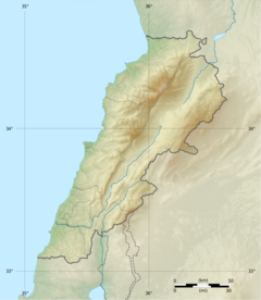
Zaarour (Arabic: زعرور ; Syriac: ܥܙܪܪܬܐ ) is a ski resort on the eastern slopes of Mount Sannine in the Matn District of Mount Lebanon Governorate, 35 km from Beirut.[1] The name is the Arabic word for hawthorn, which in itself is a corruption of a Syriac word.
The highest elevation difference at the resort is 355 m.[2] The resort introduced Handiski (a portmanteau of "handicap" and "ski") which provides specialist adaptive skiing to assist people with a disability or restricted mobility the opportunity to enjoy the pleasures of skiing.[3]
Gallery
References
- ^ Collister, Rob. Days to Remember: Adventures and Reflections of a Mountain Guide, Vertebrate Publishing, September 2016
- ^ "Lebanon: elevation differences of ski resorts". skiresort.info. Ski Resort. Retrieved November 3, 2020.
- ^ Samar Kadi (17 February 2019). "High expectations for a longer ski season in Lebanon". thearabweekly.com. The Arab Weekly. Retrieved November 3, 2020.


