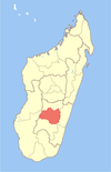
Vohimarina Lamosina
Vohimarina Lamosina | |
|---|---|
 | |
| Country | Madagascar |
| Region | Haute Matsiatra |
| District | Fianarantsoa II |
| Population (2001)[1] | |
| • Total | 17,000 |
| Time zone | UTC3 (EAT) |
Vohimarina Lamosina is a village and commune in Madagascar. It belongs to the district of Fianarantsoa II, which is a part of Haute Matsiatra Region. The population of the commune (including the other surrounding small villages) was estimated to be approximately 17,000 in the 2001 commune census.[1] Vohimarina is situated 26 km from Fianarantsoa, the nearest town and capital of the Betsileo, in the centre of Madagascar Island, in The Hauts Plateaux ("High Lands") and 450 km from Antananarivo, the capital.
Overview
Vohimarina (literally "flat mountain") and Lamosina (literally "back") are two villages separated by a few miles walking distance. The origin of the name Vohimarina came from the mountain made of a huge rock dominating the village. This mountain has a strange layout of having a flat surface on its top. It has a mysterious long and tubular shape like a beast with a huge bump and a queue (150–200 m high, 700 m length, 70 m width). The front of the rock represents a face of an animal facing the village located down to the west direction. This rock is seen from a radius of 10 km and Lamosina is the farthest village seen from the top of the mountain. Lamosina had its name because it is the extreme village seen from the roof [tafo] of the rock, roof that is like a bump or a back [lamosina]. For many years, the two villages have been twinned in name but still separated by a distance of 5 miles. Vohimarina is bigger than Lamosina and historically from French rule [before the independence], Vohimarina is the biggest administrative unit [canton]. Lamosina like the other small villages= Anjanomalaza, Vohibe, Matahimasy, Vahambe are under Vohimarina authority. To reach Vohimarina, one needs to drive a 4 x 4 wheel car; follow the national Road RN7 [direction South to Tulear]. From Fianarantsoa, you pass Mahazengy, Soaindrana, Talata Ampano and at Andranovorivato you turn right. From this point,the road is no longer asphalted. The 12 km that separate Andranovorivato to Vohimarina take 45 minutes/one hour because the road is barely practicable with bumps, holes,hills and the two bridges have been damaged by the cyclones. you need to be careful when crossing as two trunks of trees are lied in parallel to reach the gap so be accurate your vehicle pass on them. The Rock [mountain] will be on the left, you will follow the right flank and finally pass in front of the head of the "beast" before going down to the village. Vohimarina is made of typical Malagasy houses that surround the Place du Marche [Market Place]. The market day is Sabotsy [Saturday] and therefore Vohimarina is nicknamed Sabotsy. Lamosina is 5 miles away heading to the West and amazingly it is a replica of Vohimarina with its Market place but smaller in size. The Vohimarina Rock [mountain] has been for many years subject of angano (myths), tantara (stories), and fady (taboos) in Malagasy oral culture. It is potentially an attraction for tourists and mainly for those involved in trekking and walk, but still need to be explored [climbing the mountain need an inhabitant's help and guide]. Le Programme Regional de Developpement [Regional Plan for Development]is aiming to protect areas presenting "fauna and flora in danger" in the Haute Mahatsiatra. Vohimarina Lamosina is classified in " ZONES DE CONSERVATIONS NATURELLES"= [AREAS OF NATURAL CONSERVATION] that is filed under "RELIQUE DE FORET NATURELLE SERVANT D'HABITAT A DES LEMURIENS"= [REMAINING OF NATURAL FOREST USED BY LEMURS AS HABITAT]
Primary and junior level secondary education are available at Vohimarina. The majority 98% of the population of the commune are farmers. The most important crops are rice and beans, while other important agricultural products are peanuts and cassava. Services provide employment for 2% of the population.[1]
References and notes
- ^ a b c "ILO census data". Cornell University. 2002. Retrieved 2008-05-01.

