Leimuiderbrug
Appearance
Leimuiderbrug | |
|---|---|
Hamlet | |
 | |
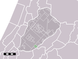
 Leimuiderbrug in the municipality of Haarlemmermeer. | |
| Coordinates: 52°14′N 4°40′E / 52.233°N 4.667°E | |
| Country | Netherlands |
| Province | North Holland |
| Municipality | Haarlemmermeer |
| Time zone | UTC+1 (CET) |
| • Summer (DST) | UTC+2 (CEST) |
| Postal code | 2155 .. |
| Dialing code | 0172 |
Leimuiderbrug is a hamlet in the Dutch province of North Holland. It is a part of the municipality of Haarlemmermeer, and lies about 11 km west of Amsterdam.
Leimuiderbrug has a population of around 40.[1]
