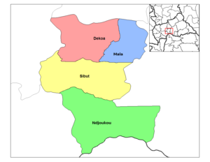
Dekoa
Appearance
Dekoa
Dékoua | |
|---|---|
Sub-prefecture and town | |
 Sub-prefectures of Kémo | |
| Coordinates: 6°19′N 19°4′E / 6.317°N 19.067°E | |
| Country | |
| Prefecture | Kémo |
| Time zone | UTC+1 (WAT) |
Dekoa[1] (Dékoua[2]) is a sub-prefecture and town in the Kémo Prefecture of the south-eastern Central African Republic.
History
In the nineteenth century freebooter Rabih az-Zubayr brought Dekoa under his sway and made it a part of the Bornu Empire. In March 1899, the sultan captured and imprisoned the explorer Ferdinand de Béhagle at Dekoa. Béhagle was subsequently hanged after the French battled the sultan's troops at Kouno in October of that year.[3][4]
Notes
- ^ Dekoa (Approved) at GEOnet Names Server, United States National Geospatial-Intelligence Agency
- ^ Dékoua (Variant) at GEOnet Names Server, United States National Geospatial-Intelligence Agency
- ^ Kalck, Pierre (2005). Historical Dictionary Of The Central African Republic. Lanham, Maryland: Scarecrow Press. p. 23. ISBN 978-0-8108-4913-6.
- ^ Zakari, Maikorema (1979). Rabih au Bornou (1893-1900): une étape de la colonisation française (in French). Niamey, France: Institut de recherches en sciences humaines, Université de Niamey. p. 84. OCLC 7554186.


