Śmiłowice, Mikołów
Śmiłowice | |
|---|---|
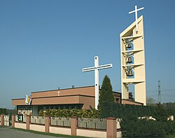
 Our Lady of Częstochowa church | |
 | |
| Coordinates: 50°12′05″N 18°51′40″E / 50.20139°N 18.86111°E | |
| Country | |
| Voivodeship | Silesian |
| County/City | Mikołów |
| Time zone | UTC+1 (CET) |
| • Summer (DST) | UTC+2 (CEST) |
| Area code | (+48) 032 |
Śmiłowice (Template:Lang-de) is a sołectwo of Mikołów, Silesian Voivodeship, southern Poland.[1] It was an independent village but as a part of gmina Mokre was administratively merged into Mikołów in 1975.[2][3]
History
The village was first mentioned in the 14th century.[3] During the political upheaval caused by Matthias Corvinus the land around Pszczyna was overtaken by Casimir II, Duke of Cieszyn, who sold it in 1517 to the Hungarian magnates of the Thurzó family, forming the Pless state country. In the accompanying sales document issued on 21 February 1517 the village was mentioned as Smilowicze.[4]
After World War I in the Upper Silesia plebiscite 231 out of 266 voters in Śmiłowice voted in favour of joining Poland, against 35 opting for staying in Germany.[5]
In years 1945-1954 it was a seat of a gmina encompassing also Mokre, Borowa Wieś, Paniowy and Stara Kuźnia (now part of Halemba district of Ruda Śląska). In 1973 the gmina was re-established but with the seat moved to Mokre, and two years later absorbed by Mikołów (apart from Stara Kuźnia).
References
- ^ "Jednostki pomocnicze" (in Polish). Retrieved 2015-05-06.
- ^ Rozporządzenie Rady Ministrów z dnia 22 maja 1975 r. w sprawie zmiany granic, Dz. U., 1975, vol. 15, No. 87
- ^ a b "Zarys historii sołectw mikołowskich i dzielnicy Kamionka" (in Polish). Retrieved 2015-05-06.
- ^ Musioł, Ludwik (1930). "Dokument sprzedaży księstwa pszczyńskiego z dn. 21. lutego 1517 R." Roczniki Towarzystwa Przyjaciół Nauk na Śląsku. R. 2. Katowice: nakł. Towarzystwa ; Drukiem K. Miarki: 235–237. Retrieved 12 September 2014.
- ^ "Results of the Upper Silesia plebiscite in Pless/Pszczyna County" (in German). Retrieved 2015-05-03.
