Aalsmeerderbrug
Appearance
Aalsmeerderbrug | |
|---|---|
Unincorporated community | |
 | |
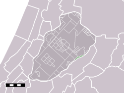
 Aalsmeerderbrug in the municipality of Haarlemmermee | |
 | |
| Coordinates: 52°16′N 4°45′E / 52.267°N 4.750°E | |
| Country | Netherlands |
| Province | North Holland |
| Municipality | Haarlemmermeer |
| Population | 500 |
Aalsmeerderbrug (Dutch pronunciation: [ˈaːlsmeːrdərˌbrɵx]) is a hamlet in the Dutch province of North Holland. It is a part of the municipality of Haarlemmermeer, and lies about 6 kilometres (3.7 mi) southeast of Hoofddorp.
Aalsmeerderbrug has a population of around 500.[1]
References
- ^ Statistics Netherlands (CBS), Gemeente Op Maat 2004: Haarlemmermeer [1][permanent dead link].
