
Sieroniowice
Sieroniowice | |
|---|---|
Village | |
 Houses | |
 Sieroniowice | |
| Coordinates: 50°27′N 18°21′E / 50.450°N 18.350°E | |
| Country | |
| Voivodeship | Opole |
| County | Strzelce |
| Gmina | Ujazd |
| Population | 640 |
Sieroniowice [ɕɛrɔɲɔˈvit͡sɛ] (German: Schironowitz) is a village in the administrative district of Gmina Ujazd, within Strzelce County, Opole Voivodeship, in south-western Poland.[1] It lies approximately 7 kilometres (4 mi) north of Ujazd, 8 km (5 mi) south-east of Strzelce Opolskie, and 39 km (24 mi) south-east of the regional capital Opole.
Before 1945 the area was part of Germany (see Territorial changes of Poland after World War II).
The village has a population of 640.
Gallery
-
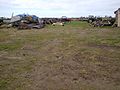 Agriculture machinery
 -
 Pond
Pond -
 Church of Our Lady of Fátima


External links
- Jewish Community in Sieroniowice on Virtual Shtetl
References
Wikimedia Commons has media related to Sieroniowice.
| Town and seat |  | |
|---|---|---|
| Villages | ||
50°27′N 18°21′E / 50.450°N 18.350°E
This Strzelce County location article is a stub. You can help Wikipedia by expanding it. |