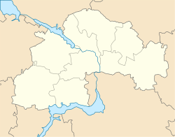
Mahdalynivka
Mahdalynivka
Магдалинiвка | |
|---|---|
Urban-type settlement | |
| Coordinates: 48°54′57″N 34°55′06″E / 48.91583°N 34.91833°E | |
| Country | Ukraine |
| Oblast | Dnipropetrovsk Oblast |
| Raion | Mahdalynivka Raion |
| Population (2017) | |
| • Total | 6,347[1] |
| Time zone | UTC+2 (EET) |
| • Summer (DST) | UTC+3 (EEST) |
Mahdalynivka (Ukrainian: Магдалинiвка; Russian: Магдалиновка) is an urban-type settlement in Dnipropetrovsk Oblast in Ukraine and the administrative center of Mahdalynivka Raion. Population: 6,347 (2017 est.)[1]
Mahdalynivka is located on the Chaplinka River, a left tributary of the Dnieper.
Economy
Transportation
Mahdalynivka is connected by roads with Dnipro and Petrykivka (with further access over the bridge to Kamianske). There are local roads as well.
The closest railway station is in Hubynykha, about 20 kilometres (12 mi) east of Mahdalynivka, on the railway line connecting Dnipro and Kharkiv.
References
- ^ a b "Чисельність наявного населення України (Actual population of Ukraine)" (in Ukrainian). State Statistics Service of Ukraine. Retrieved 26 August 2017.

