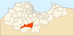
Birtouta
Appearance
Birtouta
بئر توتة | |
|---|---|
Commune and town | |
 | |
| Country | |
| Province | Algiers Province |
| District | Birtouta District |
| Area | |
| • Land | 10.55 sq mi (27.32 km2) |
| Population (2008[1]) | |
• Total | 30,575 |
| • Density | 2,898/sq mi (1,119.1/km2) |
| Time zone | UTC+1 (CET) |
Birtouta (Template:Lang-ar) is a town and commune in Algiers Province, Algeria. As of 2008[update], the commune had a total population of 30,575.[1]
See also
References
- ^ a b "Algeria: Administrative Division (Provinces and Communes)". citypopulation.de. Retrieved 26 December 2014.

