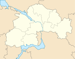
Sofiivka, Dnipropetrovsk Oblast
Appearance
Sofiyivka
Софіївка | |
|---|---|
Urban-type settlement | |
| Coordinates: 48°03′0″N 33°52′0″E / 48.05000°N 33.86667°E | |
| Country | Ukraine |
| Oblast | Dnipropetrovsk Oblast |
| Raion | Sofiyivka Raion |
| Population (2017) | |
| • Total | 6,851[1] |
| Time zone | UTC+2 (EET) |
| • Summer (DST) | UTC+3 (EEST) |
Sofiyivka (Ukrainian: Софіївка; Russian: Софиевка) is an urban-type settlement in Dnipropetrovsk Oblast in Ukraine and the administrative center of Sofiyivka Raion. Population: 6,851 (2017 est.)[1]
Sofiyivka is located on the banks of the Kamianka River, a right tributary of the Bazavluk River in the basin of the Dnieper.
Economy
Transportation
Sofyivka is on the H11 highway which connects Dnipro and Kryvyi Rih. It also have road access to Apostolove in the south and Piatykhatky in the north.
The closest railway station is in Devladove, about 10 kilometres (6.2 mi) northwest of Sofiyivka, on the railway connecting Dnipro and Kryvyi Rih.
References
- ^ a b "Чисельність наявного населення України (Actual population of Ukraine)" (in Ukrainian). State Statistics Service of Ukraine. Retrieved 26 August 2017.

