Amaravai
Appearance
Amaravai | |
|---|---|
village | |
 Amaravai | |
| Coordinates: 15°57′50″N 77°56′28″E / 15.96389°N 77.94111°E | |
| Country | |
| State | Telangana |
| District | Mahaboob Nagar |
| Languages | |
| • Official | Telugu |
| Time zone | UTC+5:30 (IST) |
| PIN | 509128 |
| Vehicle registration | AP22 |
| Nearest city | Kurnool |
| Lok Sabha constituency | Nagarkurnool |
| Vidhan Sabha constituency | Alampur |
| Climate | hot (Köppen) |
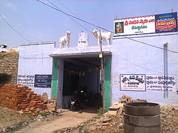
Amaravai is a village in Manopadu Mandal in Mahbubnagar district of Telangana state, India.
References
