Guaratiba
Guaratiba | |
|---|---|
Neighborhood | |
| Coordinates: 23°04′05″S 43°33′42″W / 23.06806°S 43.56167°W | |
| Country | |
| State | Rio de Janeiro (RJ) |
| Municipality/City | Rio de Janeiro |
| Zone | West Zone |

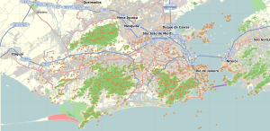
Guaratiba is a large neighborhood located in the West Zone of Rio de Janeiro, Brazil. It has one of the city's smallest population densities.
The bairro is in the eastern part of Sepetiba Bay. It contains the 3,360 hectares (8,300 acres) Guaratiba Biological Reserve, a strictly protected conservation unit holding a renmant of mangroves.[1]

The region is currently expanding due to real estate investment because the access to the neighborhood is predisposed to be made easier due to Grota Funda tunnel (pt), scheduled to be finished in 2008.[2]
References
- ^ Reserva Biológica Estadual de Guaratiba (in Portuguese), INEA, retrieved 2016-04-26
- ^ "Sinalização ruim da Serra da Grota Funda". RJTV/Globo. Retrieved 2008-04-15.

