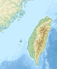
Mount Daxue
Appearance
| Daxue Mountain | |
|---|---|
 | |
| Highest point | |
| Elevation | 3,530 m (11,580 ft)[1] |
| Listing | 100 Peaks of Taiwan |
| Coordinates | 24°20′31″N 121°07′29″E / 24.341944°N 121.124722°E[2] |
| Geography | |
| Location | Miaoli County/Taichung, Taiwan |
| Parent range | Xueshan Range |
Dasyueshan (Chinese: 大雪山; Hanyu Pinyin: Dàxuě Shān; Tongyong Pinyin: Dàsyuě Shan; Wade–Giles: Da4-hsueh3 Shan1; lit. 'big snow mountain')[2] is a mountain in Taiwan along the Xueshan Range with an elevation of 3,530 m (11,580 ft).[1]
The Dasyueshan National Forest Recreation Area in Heping District, Taichung, contains a section of Dasyueshan, consisting of several shorter peaks, with Siaosyueshan (Little Snow Mountain) being the tallest at 2997m. Formerly a logging area, many of the affected areas have been reforested and it has become a popular scenic destination and birdwatching spot. Bird species seen here include the Mikado pheasant, Swinhoe's pheasant, and Taiwan partridge.
See also
References
- ^ a b The Republic of China Yearbook 2014. Executive Yuan. 2014. p. 43. ISBN 978-986-04-2302-0.
- ^ a b "GeoNames Search". Geographic Names Database. National Geospatial-Intelligence Agency, USA. Retrieved 5 September 2016.

