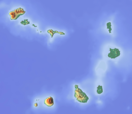
Pico de Alberto
Appearance
| Pico de Alberto | |
|---|---|
eastern São Nicolau Island, Cape Verde | |
| Highest point | |
| Elevation | 598 m (1,962 ft) |
| Listing | List of mountains in Cape Verde |
| Coordinates | 16°35′15″N 24°7′15″W / 16.58750°N 24.12083°W |
| Geography | |
| Location | eastern São Nicolau Island, Cape Verde |
| Climbing | |
| Easiest route | climb |
Pico de Alberto is a mountain in the eastern part of São Nicolau island in Cape Verde. Its elevation is 598 m.[1] The mountain's summit is located south of the village Juncalinho.
References
[edit]


