Fuerte de San García
You can help expand this article with text translated from the corresponding article in Spanish. (May 2013) Click [show] for important translation instructions.
|
| San Garcia Fort | |
|---|---|
| Native name Fuerte de San García (Spanish) | |
 the remains of the Fuerte de San García | |
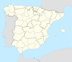
| Location | Algeciras, Spain |
| Built | 1730s |
| Official name | Fuerte de San García |
| Type | Non-movable |
| Criteria | Monument |
Fuerte de San García was a fort in Algeciras, Spain, It was built in the 1730s and destroyed in 1811 to deny it to the French. Today all that remains are the foundation and base ruins, in the Parque del Centenario, but it is a registered Bien de Interés Cultural landmark
The Spanish fortifications around Gibraltar were destroyed in 1810 to deny their use by Napoleon's forces. the fortifications around the bay were removed by Portuguese sailors and this was only shortly before the French cavalry arrived in nearby San Roque.[1] The main Spanish lines were destroyed by Colonel Sir Charles Holloway on 14 February 1810. Following the main explosion other towers were destroyed and volunteers took away the rubble.[2]
References
- ^ Jackson, Sir William G. F. (1990). The rock of the Gibraltarians : a history of Gibraltar (2nd ed.). Grendon: Gibraltar Books. p. 213. ISBN 0948466146.
- ^ Musteen, Jason R (2011). Nelson's Refuge Gibraltar in the Age of Napoleon. New York: Naval Institute Press. ISBN 1612510841.
36°06′22″N 5°25′54″W / 36.10611°N 5.43167°W
- 18th-century fortifications
- Forts in Spain
- Buildings and structures in Algeciras
- Demolished buildings and structures in Spain
- 1730s architecture
- Buildings and structures in Spain demolished during the Peninsular War
- Former military buildings and structures
- Bien de Interés Cultural landmarks in the Province of Cádiz
- Buildings and structures demolished in 1811
- Province of Cádiz building and structure stubs
- Andalusia stubs


