Goose Island, New York
Appearance
Goose Island, New York | |
|---|---|
| Coordinates: 43°15′15″N 73°25′25″W / 43.25417°N 73.42361°W | |
| Country | United States |
| State | New York |
| County | Washington |
| Elevation | 718 ft (219 m) |
| Time zone | UTC-5 (Eastern (EST)) |
| • Summer (DST) | UTC-4 (EDT) |
| Area code | 518 |
| GNIS feature ID | 972554[1] |
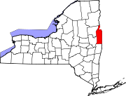
Goose Island is a hamlet in Argyle, Washington County, New York, United States.[1] It is located along County Route 47 near the Argyle - Hebron Town lines and consists of a small number of farms and homes clustered near the intersection of County Route 47 and Goose Island Road. North of the intersection on Goose Island Road is the Goose Island Potato Farm where the McKernon families host U-Pick events on several weekends each year [2].
References


