
Gentian, Michigan
Gentian, Michigan | |
|---|---|
 Gentian Location within the state of Michigan | |
| Coordinates: 46°25′52″N 87°28′00″W / 46.43111°N 87.46667°W | |
| Country | United States |
| State | Michigan |
| County | Marquette |
| Township | Sands |
| Elevation | 1,243 ft (379 m) |
| Time zone | UTC-5 (Eastern (EST)) |
| • Summer (DST) | UTC-4 (EDT) |
| ZIP code(s) | 49855 |
| Area code | 906 |
| GNIS feature ID | 1617580[1] |
Gentian is an unincorporated community in Marquette County, in the U.S. state of Michigan.[1]
History
Gentian was named from the fringed gentian flowers growing near the town site.[2]
References
- ^ a b U.S. Geological Survey Geographic Names Information System: Gentian, Michigan
- ^ Chicago and North Western Railway Company (1908). A History of the Origin of the Place Names Connected with the Chicago & North Western and Chicago, St. Paul, Minneapolis & Omaha Railways. p. 75.
Municipalities and communities of Marquette County, Michigan, United States | ||
|---|---|---|
| Cities | 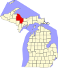 | |
| Charter townships | ||
| Civil townships | ||
| CDPs | ||
| Other communities | ||
| Indian reservations | ||
| Footnotes | ‡This populated place also has portions in an adjacent county or counties | |
This Marquette County, Michigan location article is a stub. You can help Wikipedia by expanding it. |