
Hailstone, Utah

Hailstone
Location of the former town of Hailstone within the State of Utah
Hailstone, Utah was a town in northern Wasatch County, Utah, United States.[1]
Description
Hailstone was located at the junction on the former routing of US‑40 and US‑189, 7 miles (11 km) north of Heber City.[2] It was submerged in 1995 by the waters of Jordanelle Reservoir along with Jordanelle and Keetley.
Originally known as Elkhorn, Hailstone was homesteaded in 1864 by William Paret Hailstone, Ann Davis Hailstone, and others. The town was a base for mining, ranching, and logging.[3]
See also
References
- ^ "Hailstone". Geographic Names Information System. United States Geological Survey, United States Department of the Interior.
- ^ "MyTopo Maps - Hailstone, UT, USA" (Map). mytopo.com. Trimble Navigation, Ltd. Retrieved 16 Feb 2018.
- ^ Van Cott, John W. (1990). Utah Place Names: A Comprehensive Guide to the Origins of Geographic Names: A Compilation. Salt Lake City: University of Utah Press. p. 173. ISBN 978-0-87480-345-7. OCLC 797284427.
External links
![]() Media related to Hailstone, Utah at Wikimedia Commons
Media related to Hailstone, Utah at Wikimedia Commons
40°36′30″N 111°24′40″W / 40.60833°N 111.41111°W
Municipalities and communities of Wasatch County, Utah, United States | ||
|---|---|---|
| Cities | 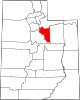 | |
| Towns | ||
| CDP | ||
| Unincorporated community | ||
| Indian reservation | ||
| Ghost towns | ||
| Footnotes | ‡This populated place also has portions in an adjacent county or counties | |
This article about a location in Utah is a stub. You can help Wikipedia by expanding it. |