Horvat Uza
Appearance
This article has multiple issues. Please help improve it or discuss these issues on the talk page. (Learn how and when to remove these messages)
|
חורבת עוזה | |
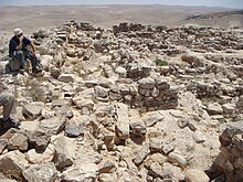
 Hurvat Uzza, overlooking Kina River at Arad Valley, Israel. | |
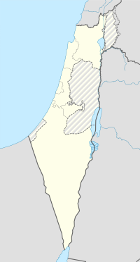
| Location | Negev, Israel |
|---|---|
| Coordinates | 31°12′33″N 35°09′56″E / 31.20917°N 35.16556°E |
Horvat Uza (Hebrew: חורבת עוזה) is an archaeological site located in the northeast of the Negev desert in Israel. The site is located in the east of the Arad valley and overlooks the Qinah nahal. In ancient times, forts were established there to control the wadi road, linking Judea to Arabah and the territory of Edom. It was mentioned as Qina by Josephus in book 15 of his Antiquities.[1]

