
Babino Polje
Babino Polje | |
|---|---|
 Babino Polje Location of Babino Polje within Croatia | |
| Coordinates: 42°44′08″N 17°33′03″E / 42.73556°N 17.55083°E | |
| Country | Croatia |
| County | Dubrovnik-Neretva County |
| Municipality | Mljet |
| Population | |
| • Total | 270 |
| Time zone | UTC+1 (CET) |
| • Summer (DST) | UTC+2 (CEST) |
| Postal code | 20225 Babino Polje |
Babino Polje is a village in Dalmatia, southern Croatia. With a population of 270, it is the largest settlement on the island of Mljet and it is connected by the D120 state road.
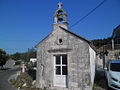
Gallery
-

-

-

-

-

-

-
-
![]](//upload.wikimedia.org/wikipedia/commons/thumb/7/71/Crkvica_i_groblje_u_Babinom_Polju.JPG/120px-Crkvica_i_groblje_u_Babinom_Polju.JPG) ]
] -
-


![]](/wiki/File:Crkvica_i_groblje_u_Babinom_Polju.JPG)


References
- ^ "Population by Age and Sex, by Settlements, 2011 Census: Babino Polje". Census of Population, Households and Dwellings 2011. Zagreb: Croatian Bureau of Statistics. December 2012.
42°44′08″N 17°33′03″E / 42.73556°N 17.55083°E
This Dubrovnik-Neretva County geography article is a stub. You can help Wikipedia by expanding it. |