
Guirim
Guirim | |
|---|---|
city | |
 Guirim Location in Goa, India  Guirim Guirim (India) | |
| Coordinates: 15°35′N 73°48′E / 15.58°N 73.80°E | |
| Country | |
| State | Goa |
| District | North Goa |
| Elevation | 7 m (23 ft) |
| Population (2001) | |
| • Total | 6,371 |
| Languages | |
| • Official | Konkani |
| Time zone | UTC+5:30 (IST) |
| Vehicle registration | GA |
| Website | goa |
Guirim is a census town in North Goa district in the Indian state of Goa.
Geography
Guirim is located at 15°33′48″N 73°48′55″E / 15.563419°N 73.815237°E .[1] It has an average elevation of 7 metres (23 feet).
Demographics
As of 2001[update] India census,[2] Guirim had a population of 6371. Males constitute 51% of the population and females 49%. Guirim has an average literacy rate of 70%, higher than the national average of 59.5%: male literacy is 75%, and female literacy is 65%. In Guirim, 12% of the population is under 6 years of age.
Gallery
- Life in Guirim
-
 St Antonio Chapel
 -
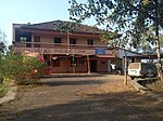 Village Panchayat
 -
 Guirim Cross
 -
 St Diogo's Church


References
- ^ Falling Rain Genomics, Inc - Guirim
- ^ "Census of India 2001: Data from the 2001 Census, including cities, villages and towns (Provisional)". Census Commission of India. Archived from the original on 16 June 2004. Retrieved 1 November 2008.
This article related to a location in the Indian state of Goa is a stub. You can help Wikipedia by expanding it. |