Somerset Monument
| Monument to Lord Robert Edward Somerset | |
|---|---|
 | |
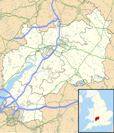
| Location | Hawkesbury Upton, Gloucestershire, England |
| Coordinates | 51°35′14″N 2°19′48″W / 51.5872°N 2.3301°W |
| Built | 1846 |
| Architect | Lewis Vulliamy |
Listed Building – Grade II* | |
| Official name | Monument to Lord Robert Edward Somerset |
| Designated | 10 November 1983[1] |
| Reference no. | 1320834 |
The Somerset Monument in Hawkesbury Upton, Gloucestershire, England was built in 1846 to commemorate Lord Robert Edward Somerset. It is a Grade II* listed building.[1]
History
Lord Robert Edward Somerset was a British soldier who fought during the Peninsular War and the War of the Seventh Coalition. From 1830[2] sat for Gloucestershire and from 1834[3] to 1837 was MP for Cirencester.
The memorial was designed by Lewis Vulliamy,[1] and built by staff from the nearby Badminton House estate which was the principal seat of the Dukes of Beaufort since the late 17th century.
Architecture

The stone tower is around 100 feet (30 m) high and has a viewing platform at the top.[1] The structure tapers slightly and has four pannelled sides. On the southern panel is the arms of the Somerset family.[1]
At the base of the tower is a lodge and ornamental garden.[4]
References
- ^ a b c d e "Monument to Lord Robert Edward Somerset". National Heritage List for England. Historic England. Retrieved 19 November 2018.
- ^ "No. 18717". The London Gazette. 13 August 1830. p. 1736.
- ^ "No. 19180". The London Gazette. 8 August 1834. p. 1462.
- ^ "Hawkesbury Conservation Area" (PDF). South Gloucestershire Council. Retrieved 19 November 2018.

