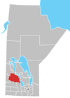
Fork River, Manitoba
Fork River, Manitoba | |
|---|---|
| Country | Canada |
| Province | Manitoba |
| Government | |
| • Reeve | Ron Kostyshyn |
| Time zone | UTC-6 (CST) |
| • Summer (DST) | UTC-5 (CDT) |
| Postal code | R0L 0V0 |
| Area code | (204)-657-2 |
Fork River is about 13 km south of Winnipegosis, Manitoba 25 mins. north of Dauphin. It is located in the Rural Municipality of Mossey River. It is mainly surrounded by farmland.
History
Fork River at one time had over 200 inhabitants, but has since dwindled. It also had a number of stores, but the last one closed in 1996. It still has an operational granary, and used to have regular stops from passing trains, but the tracks are no longer used. As of the turn of the millennium, the tracks have been removed. Commodities are transported solely by large trucks.
The main route of transportation is Highway 20.
Fork River also has a skating rink that has over 100 people that visit over a winter season. The hall is also used for many weddings and socials, and has a weekly Thursday night Bingo.

