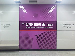
Yangjae Citizen's Forest station
Appearance
Yangjae Citizen's Forest (Maeheon) Station | |
|---|---|
 | |
| General information | |
| Location | 237 Yangjae-dong Seocho-gu, Seoul |
| Operated by | NeoTrans Co. Ltd. |
| Line(s) | Lua error: expandTemplate: template "SMS color" does not exist. |
| Platforms | 2 |
| Tracks | 2 |
| Construction | |
| Structure type | Underground |
| Key dates | |
| October 28, 2011 | Lua error: expandTemplate: template "SMS color" does not exist. opened |
Yangjae Citizen's Forest (Maeheon) Station is a subway station in Seoul, South Korea, on Seoul Metropolitan Subway's Shinbundang Line. It opened on October 28, 2011.[1]
Naming
It is named for the nearby Yangjae Citizens' Forest which is located near Yangjae Tollgate on the Gyeongbu Highway, the entrance to Seoul City.
Yangjae Stream
Yangjae Stream, or Yangjaecheon in Korean, is a 5.5 kilometres (3.4 mi)—long body of water that stretches from Gwanak-san through the southern area of Gangnam Station and Gangnam-gu. There are two swimming areas for kids, a number of stepping stone bridges to cross, and two sites for an ecosystem watch.[2]
Station layout
| G | Street level | Exit |
| L1 Concourse |
Lobby | Customer Service, Shops, Vending machines, ATMs |
| L2 Platform level |
Side platform, doors will open on the left | |
| Southbound | → Shinbundang Line toward Gwanggyo (Cheonggyesan) → | |
| Northbound | ← Shinbundang Line toward Yongsan (Yangjae) | |
| Side platform, doors will open on the left | ||
Exits
Five exits:
- NW corner of Gangnam-daero and Maeheon-ro
- NE corner of Gangnam-daero and Maeheon-ro
- SE corner of Gangnam-daero and Maeheon-ro
- SW corner of Gangnam-daero and Maeheon-ro
- Maeheon-ro west of Gangnam-daero (the entrance of the forest)

