Caimito Formation
Appearance
| Caimito Formation | |
|---|---|
| Stratigraphic range: Late Oligocene-Early Miocene | |
| Type | Formation |
| Underlies | Alajuela & Gatún Formations |
| Overlies | Bohío, Caraba & Gatuncillo Formations, Cretaceous basement |
| Lithology | |
| Primary | Marl |
| Other | Siltstone, sandstone, conglomerate |
| Location | |
| Coordinates | 9°12′N 79°48′W / 9.2°N 79.8°W |
| Approximate paleocoordinates | 7°42′N 77°30′W / 7.7°N 77.5°W |
| Region | Panamá Province |
| Country | |
| Extent | Panama Basin |
| Type section | |
| Named for | Caimito Junction of Panama Railroad |
| Named by | MacDonald |
| Year defined | 1913 |
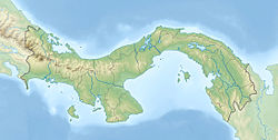
The Caimito Formation (Tcm)[1] is a geologic formation in Panama. The marls, sandstones and conglomerates preserve bivalve and gastropod fossils dating back to the Late Oligocene to Early Miocene period.[2] The name Caimito was proposed by MacDonald in 1913, named after the Caimito junction in the Panama Railroad during the construction of the Panama Canal.[3]
See also
References
- ^ Geologic Map, 1980
- ^ Caimito Formation at Fossilworks.org
- ^ Woodring, 1957, p.28

