
Krasowa
Krasowa | |
|---|---|
Village | |
,_ulice_II.jpg) Street | |
 Krasowa | |
| Coordinates: 50°24′N 18°9′E / 50.400°N 18.150°E | |
| Country | |
| Voivodeship | Opole |
| County | Strzelce |
| Gmina | Leśnica |
Krasowa [kraˈsɔva] (German: Krassowa) is a village in the administrative district of Gmina Leśnica, within Strzelce County, Opole Voivodeship, in south-western Poland.[1] It lies approximately 4 kilometres (2 mi) south-west of Leśnica, 15 km (9 mi) south-west of Strzelce Opolskie, and 34 km (21 mi) south-east of the regional capital Opole.
Before 1945 the area was part of Germany (see Territorial changes of Poland after World War II).
Gallery
-
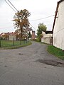 Street
 -
 Barn
Barn -
 House
House
,_ulice_III.jpg)
,_stodola.jpg)
,_d%C5%AFm.jpg)
References
| Town and seat |  | |
|---|---|---|
| Villages | ||
50°24′N 18°09′E / 50.4°N 18.15°E
This Strzelce County location article is a stub. You can help Wikipedia by expanding it. |