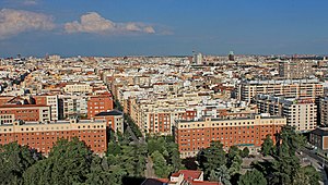
Gaztambide (Madrid)
Appearance
This is an old revision of this page, as edited by Asqueladd (talk | contribs) at 09:02, 18 September 2019 (added Category:Gaztambide neighborhood, Madrid using HotCat). The present address (URL) is a permanent link to this revision, which may differ significantly from the current revision.
Gaztambide | |
|---|---|
 | |
 | |
| Country | Spain |
| Autonomous community | Madrid |
| Municipality | Madrid |
| District | Chamberí |
Gaztambide is a ward (barrio) of Madrid belonging to the district of Chamberí.
40°26′5″N 3°42′53″W / 40.43472°N 3.71472°W / 40.43472; -3.71472
This article about a location in the Community of Madrid, Spain is a stub. You can help Wikipedia by expanding it. |