São Sebastião Lighthouse
Appearance
 | |
 | |
| Location | São Tomé, São Tomé and Príncipe |
|---|---|
| Coordinates | 0°20′46″N 6°44′22″E / 0.3460°N 6.7395°E |
| Tower | |
| Constructed | 1928 |
| Height | 6 metres (20 ft)[1] |
| Shape | round tower |
| Heritage | Heritage of Portuguese Influence |
| Light | |
| Focal height | 14 metres (46 ft)[1] |
| Range | 9 nautical miles (17 km; 10 mi) |
| Characteristic | Fl(4) WR 12s |
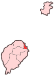
São Sebastião Lighthouse (Template:Lang-pt) is a lighthouse in the São Sebastião fortress at the southeastern end of Ana Chaves Bay in São Tomé, capital of São Tomé and Príncipe. The lighthouse is a 6 metres high white round tower with a red lantern.[1] It was built in 1928.[3] Its focal height is 14 metres.[1]
See also
References
- ^ a b c d List of Lights, Pub. 113: The West Coasts of Europe and Africa, the Mediterranean Sea, Black Sea and Azovskoye More (Sea of Azov) (PDF). List of Lights. United States National Geospatial-Intelligence Agency. 2018. p. 442.
- ^ "Sao Tome & Principe". ARLHS World of Lights (WLOL). Amateur Radio Lighthouse Society. April 8, 2009. Retrieved 14 April 2009.
- ^ Rowlett, Russ. "Lighthouses of São Tomé and Príncipe". The Lighthouse Directory. University of North Carolina at Chapel Hill. Retrieved 2 October 2018.

