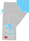
Chater, Manitoba
Appearance
Chater is an unincorporated area in the Rural Municipality of Cornwallis in the Canadian province of Manitoba.[1]
It is located near Brandon, Manitoba.[2]
49°52′02″N 99°49′53″W / 49.86722°N 99.83139°W
References
- ^ "Chater, Manitoba". Geographical Names of Canada. Natural Resources Canada. Archived from the original on June 8, 2011. Retrieved April 18, 2010.
- ^ Sparling, R. (November 7, 1890). "Across the Continent". The Huron Expositor. Seaforth, Ontario. Retrieved April 18, 2010.
Four miles beyond Chater the Assinniboine River is crossed by an iron bridge, and Brandon is reached.

