Atley Station
Atley Station is a pastoral lease that operates as a sheep and goat station in Western Australia. The property is historically significant for its long association with the pastoral industry in the Sandstone district.[1][2]
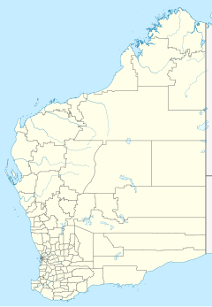
It is located along the Paynes Find-Sandstone road approximately 110 kilometres (68 mi) east of Mount Magnet and 150 kilometres (93 mi) west of Leinster in the Mid West region of Western Australia.[3]
The station had been established some time prior to 1915. The lessee in 1915 was W.N. Cock, who was running sheep on the property at the time.[4] By 1921 Wirth and Williams held the lease to the property,[5] followed by Cumberland and Black in 1924,[6] with Cumberland leaving the partnership leaving R.S. Black & Son as the leaseholders in 1927.[7] Black also later acquired Roy Hill station at some time prior to 1934.[8] Robert Silvers Black died in 1934 after a brief illness leaving his son Robin to take control of Atley.[9]
The Black family remained at the property until 1939 when it was placed on the market. At this time Atley occupied an area of 261,882 acres (105,980 ha) with most of the area fenced into 20 sheep proof paddocks and 11 holding paddocks. It was stocked with 2,500 sheep, 10 horses and 15 cattle. Buildings included the nine room homestead, shearing shed and assorted outbuildings with 16 fully equipped wells or bores. The typical flora found at Atley included mulga, kurara, saltbush, bluebush and other seasonal herbage.[10]
In 2004 the lease was held by T.J. Hodshon.[11]
See also
References
- ^ "Atley Station". InHerit. Heritage Council of Western Australia. 1 January 2017. Retrieved 25 February 2017.
- ^ "Shire of Sandstone Local Planning Strategy" (PDF). Western Australian Planning Commission. 22 March 2016. Retrieved 25 February 2017.
- ^ "Atley Station". Infobel. Retrieved 25 February 2017.
- ^ "Germany Apologises". The Black Range Courier and Sandstone Observer. Vol. VIX, no. 35. Western Australia. 1 September 1915. p. 3. Retrieved 25 February 2017 – via National Library of Australia.
- ^ "Local Wool sales". The West Australian. Vol. XXXVII, no. 6, 019. Western Australia. 2 August 1921. p. 8. Retrieved 25 February 2017 – via National Library of Australia.
- ^ "Perlh Wool Sales". Great Southern Herald. Vol. XXIII, no. 2, 426. Western Australia. 1 November 1924. p. 10. Retrieved 25 February 2017 – via National Library of Australia.
- ^ "Elder, Smith & Co". Sunday Times (Perth). No. 1555. Western Australia. 13 November 1927. p. 22. Retrieved 25 February 2017 – via National Library of Australia.
- ^ "Personal". The Yalgoo Observer and Murchison Chronicle. Western Australia. 23 March 1934. p. 3. Retrieved 25 February 2017 – via National Library of Australia.
- ^ "Mr Robert Black dead". The West Australian. Vol. 50, no. 9, 907. Western Australia. 31 March 1934. p. 12. Retrieved 25 February 2017 – via National Library of Australia.
- ^ "Advertising". The West Australian. Vol. 55, no. 16, 606. Western Australia. 22 September 1939. p. 21. Retrieved 25 February 2017 – via National Library of Australia.
- ^ "Brand BS71". Department of Agriculture and Food, Western Australia. 19 October 2015. Retrieved 25 February 2017.

