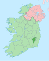
Nurney, County Carlow
Appearance
Nurney
Urnaí Nurnai | |
|---|---|
Town | |
| Coordinates: 52°45′02″N 6°54′35″W / 52.7506°N 6.9097°W | |
| Country | Ireland |
| Province | Leinster |
| County | County Carlow |
| Elevation | 144 m (472 ft) |
| Time zone | UTC+0 (WET) |
| • Summer (DST) | UTC-1 (IST (WEST)) |
| Irish Grid Reference | S736671 |
Nurney (Irish: Urnaí Nurnai, meaning 'The Prayer') is a village in County Carlow, Ireland.[1]
Historic sites
The name suggests that there may have been a monastic site on the site in the 4th or 5th century. St. John's Church (Church of Ireland) is a listed structure, which was built by the local landlord John Bruen in the 1780s along with a schoolhouse.[2]
Nurney Cross, located near St. John's Church,[3] is a very early example of a high cross and is a National Monument.

Sports
Nurney is home to Nurney Villa, an association football (soccer) club which competes in the Carlow Premier Division.[citation needed]
See also
References
- ^ "Nurney Townland, Co. Carlow". Townlands.ie. Retrieved 15 January 2016.
- ^ "Nurney National School". Bagnelstown Parish. Retrieved 15 January 2016.
- ^ "Saint John's Church of Ireland Church, Nurney, County Carlow". National Inventory of Architectural Heritage. Department of Arts, Heritage and the Gaeltacht. Retrieved 15 January 2016.


