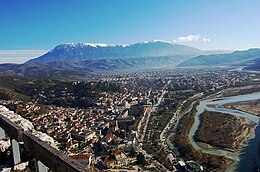
Osum Island
Appearance
 Berat Island in Osum river, Berat | |
 | |
| Geography | |
|---|---|
| Location | Osum river,Berat |
| Coordinates | 40°42′10″N 19°57′05″E / 40.70278°N 19.95139°E |
| Area | 0.03 km2 (0.012 sq mi) |
| Highest elevation | 60 m (200 ft) |
| Administration | |
Albania | |
Berat Island (Ishulli Beratit in Albanian) is an island in south-central of Albania, in the Osum river, in the city of Berat
Geography
Berat island is located in the Osum river, in the Berat Municipality, Berat District, and it has an area of 3 hectares or 0.03 square km. The island is located in the center of the city of Berat.
