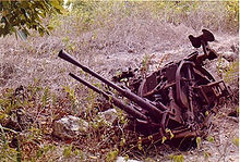
Command Ridge
Appearance
| Command Ridge | |
|---|---|
| Highest point | |
| Elevation | 65 m (213 ft)[1] |
| Prominence | 65 m (213 ft)[1] |
| Listing | Country high point |
| Coordinates | 00°31′49″S 166°55′00″E / 0.53028°S 166.91667°E |
| Geography | |
| Location | Aiwo District, Nauru |
| Geology | |
| Mountain type | Hill (Limestone) |
Command Ridge (Nauruan: Janor) is the highest point of Nauru, with an elevation of 65 metres (213 ft).
Passing close to Command Ridge is the boundary between Aiwo and Buada districts.

See also
References
- ^ a b "Nauru High Point" on Peakbagger Retrieved 24 September 2011
External links
- (in English) Adventure Details: Command Ridge, Topoworld.com.

