
Aumes
Aumes | |
|---|---|
 A general view of Aumes | |
.svg) Coat of arms | |
Location of Aumes  | |
 Aumes  Aumes | |
| Coordinates: 43°28′01″N 3°27′49″E / 43.4669°N 3.4636°E | |
| Country | France |
| Region | Occitania |
| Department | Hérault |
| Arrondissement | Béziers |
| Canton | Mèze |
| Intercommunality | CA Hérault Méditerranée |
| Government | |
| • Mayor (2014-2020) | Jean-Marie At |
| Area 1 | 7.39 km2 (2.85 sq mi) |
| Population (2021)[1] | 501 |
| • Density | 68/km2 (180/sq mi) |
| Time zone | UTC+01:00 (CET) |
| • Summer (DST) | UTC+02:00 (CEST) |
| INSEE/Postal code | 34017 /34530 |
| Elevation | 6–106 m (20–348 ft) (avg. 80 m or 260 ft) |
| 1 French Land Register data, which excludes lakes, ponds, glaciers > 1 km2 (0.386 sq mi or 247 acres) and river estuaries. | |
Aumes is a commune in the Hérault department in southern France. Guillaume d’Abbes de Cabrebolles (1718–1802), Encyclopédiste, died in Aumes.
Population
| Year | Pop. | ±% |
|---|---|---|
| 1962 | 267 | — |
| 1968 | 310 | +16.1% |
| 1975 | 305 | −1.6% |
| 1982 | 286 | −6.2% |
| 1990 | 268 | −6.3% |
| 1999 | 310 | +15.7% |
| 2008 | 420 | +35.5% |
| 2015 | 485 | +15.5% |
Images
-
 Well
Well -
 Church St-Pierre
 -
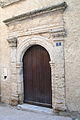 Door of the presbytery.
 -
 Church of St. Aubin
 -
 Castle Saint Martin de Graves.


See also
References
- ^ "Populations légales 2021". The National Institute of Statistics and Economic Studies. 28 December 2023.
Wikimedia Commons has media related to Aumes.
| International | |
|---|---|
| National | |
This Hérault geographical article is a stub. You can help Wikipedia by expanding it. |