
Chanteheux
Chanteheux | |
|---|---|
_mairie.jpg) The town hall in Chanteheux | |
 Coat of arms | |
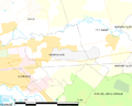
Location of Chanteheux  | |
 Chanteheux  Chanteheux | |
| Coordinates: 48°36′03″N 6°31′53″E / 48.6008°N 6.5314°E | |
| Country | France |
| Region | Grand Est |
| Department | Meurthe-et-Moselle |
| Arrondissement | Lunéville |
| Canton | Lunéville-2 |
| Intercommunality | Communauté de communes du Lunévillois |
| Government | |
| • Mayor (2008–2014) | Jacques Dewaele |
| Area 1 | 5.79 km2 (2.24 sq mi) |
| Population (2021)[1] | 2,136 |
| • Density | 370/km2 (960/sq mi) |
| Demonym | Cantenois(e) |
| Time zone | UTC+01:00 (CET) |
| • Summer (DST) | UTC+02:00 (CEST) |
| INSEE/Postal code | 54116 /54300 |
| Elevation | 222–249 m (728–817 ft) (avg. 230 m or 750 ft) |
| 1 French Land Register data, which excludes lakes, ponds, glaciers > 1 km2 (0.386 sq mi or 247 acres) and river estuaries. | |
Chanteheux is a commune in the Meurthe-et-Moselle department in north-eastern France.
Geography
Chanteheux is located in the north-east of Lunéville. The commune is crossed by the Vezouze.
-
 Mapof the commune
 -
 Chanteheux entry
 -
 The Vezouze at Chanteheux

_city_limit_sign.jpg)
_la_Vezouze.jpg)
Economy
Chanteheux has a bakery, a bar and a hairdressing salon in its center, and commercial zone in its periphery.
-
 Chanteheux, main street and shops
_rue_principale,_commerces.jpg)
Community and sports life
Chanteheux has an amateur football club, the Amicale de Chanteheux.
The family association organize every year wine fair of Lunéville, a wood fair, and Christmas market, usually taking place at the local multifunctional room.
-
 Multifunctional room of Chanteheux
 -
 The stadium, home of the Amicale de Chanteheux
_complexe_des_vieux_m%C3%A9tiers.jpg)
_stade.jpg)
Spots and monuments
- St Barthélemy Church
- War memorial
- Castle built in 1740 for the last duke of Lorraine Stanislaw Leszczynski, destructed just after his death.
-
 The church
 -
 War memorial
_%C3%A9glise_(01).jpg)
_monument_aux_morts.jpg)
See also
Wikimedia Commons has media related to Chanteheux.
| International | |
|---|---|
| National | |
This Meurthe-et-Moselle geographical article is a stub. You can help Wikipedia by expanding it. |
- ^ "Populations légales 2021". The National Institute of Statistics and Economic Studies. 28 December 2023.