
Wiadrów
Wiadrów | |
|---|---|
Village | |
 Church in Wiadrów | |
 Wiadrów Location of Wiadrów | |
| Coordinates: 50°59′N 16°11′E / 50.983°N 16.183°E | |
| Country | |
| Voivodeship | Lower Silesian |
| Powiat | Jawor |
| Gmina | Paszowice |
Wiadrów [ˈvjadruf] (German: Wederau) is a village in the administrative district of Gmina Paszowice, within Jawor County, Lower Silesian Voivodeship, in south-western Poland.[1] Prior to 1945 it was in Germany.
It lies approximately 8 km (5 mi) south of Jawor, and 62 km (39 mi) west of the regional capital Wrocław.
Gallerie
-
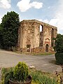 Ruin of the evangelical church
 -
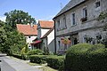 Houses
 -
 Fire station
.jpg)
.jpg)
.jpg)
References
Wikimedia Commons has media related to Wiadrów.
This Jawor County location article is a stub. You can help Wikipedia by expanding it. |